skip to content
Current Lead Times: Simple-Custom Framesets: 1 week. Full Custom Bikes: 7 weeks.

U.S. Built Custom Bicycles in Titanium and Titanium-Carbon Mix

Daniel Sharp @ Grinduro

You want to work with people who make you look good. That’s obvious. But, even more than that, you want to work with people who make what you do look good, and in this case,  photographer/adventurer Daniel Sharp makes cycling look like just about the best thing a person could do with their remaining breaths. We never fail to read a post at his Benedicto 7 and not want to ride our bikes after. Most recently Daniel was at Grinduro, doing what he does.

Photos and excerpts from his story below:

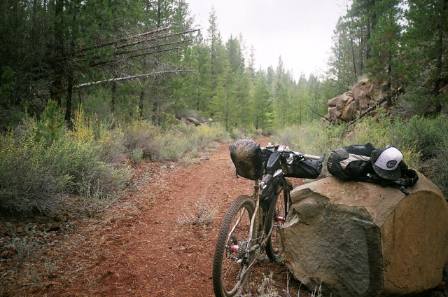
A Seven with a well fitted frame bag

Before making the 8 hour drive to Quincy, Grinduro was just soundbytes, the color purple, poster art by Geoff Mcfetridge. The event site billed it as “Gravel Road Race + Mountain Bike-Style Enduro = one long loop of pavement and dirt” When you factor in the chance to ride new dirt roads and camping and live music, well now you’ve got yourself a new-fangled-old-school mountain bike festival. DiMinno is doing the food. OK Now we’re talking. Chris Diminno is the super talented chef masterminding the food at the Chris King Gourmet Centuries. That in itself is almost enough to drive to Quincy, CA.

Riders ride into the sun

We rolled out at 8:00, past the stacks of wet timber at Sierra Pacific Industries. Nothing prepares you for the feeling of riding in such a large group. I do so much solo riding, that a group like this feels special. For me, it’s the whole reason to do a ride like this. The group takes your mind off the cold, and it distracts you when the road deteriorates to rutted gravel – and ramps up steeper than you’d like. We rode out of town, -through the valley, past a trio of running horses.

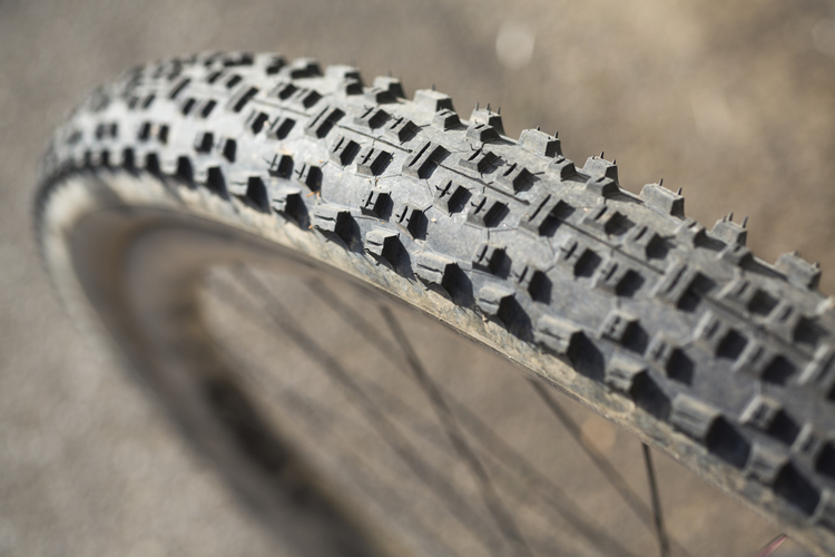
A very knobby cross tire

It didn’t take long to warm up, since the first climb seemed to be an hour long. The first timed section came at about the 45 minute mark. I couldn’t be bothered with sprinting at this point. I tried slightly harder just because I felt guilty not pushing it a bit as a few people flew by, obviously redlining it, because: racing. Being a reformed racer, I felt conflicted– like I should rise to the occasion because I’m being timed, and at the end of the day we’re going to gather around the fire and compare times. But I feel good about the efforts I’ve done this summer, and I’ve been riding plenty. My new rule as I do more longer events is pacing myself to go as hard as I can for 8 hours, which is more like an 85 percent effort, and it doesn’t allow for any massive sprint efforts. You basically find your endurance zone and stick with it.

Grinduro Climb Sign

The Grinduro signage continued, this time it said “This climb sucks SORRY” Those that knew the route said to take it as easy as possible on this climb, since the final singletrack section was supposed to be the hardest bit. Honestly though, with sections at 12 and 13 percent grade, the only way to chill out was to walk your bike, and that makes it take forever and isn’t that much fun. My legs were feeling good, so I just shifted down to my 36 and found a rhythm. I tell myself I love climbing and when my legs feel good like this I actually do love climbing. But that much steepness and that long of a climb have a way of stealing any good vibes and just make you grateful to be done.

Check out more of Daniel’s work at Daniel Sharp Photography.

On the Road – Daniel Sharp at Oregon Outback

Daniel Sharp and his Benedicto crew have been at it again. This time taking on the Oregon Outback. We find that the best thing to do with Daniel is to get out of the way and let his words and pictures tell the story, so we’ll do that. This isn’t nearly the whole story or all the pictures, just an excerpt.

I think I was nervous about the Outback. I didn’t sleep well for an entire week leading up to it. My mind was wound up with to-do lists and what-if scenarios. I had managed some good hard 60 to 70 mile road rides, but hadn’t done much fully loaded. What about the Bay Area Ridge Trail? That was 300 miles in 3 days, but that was six months ago and we packed light. What if I implode on day one?

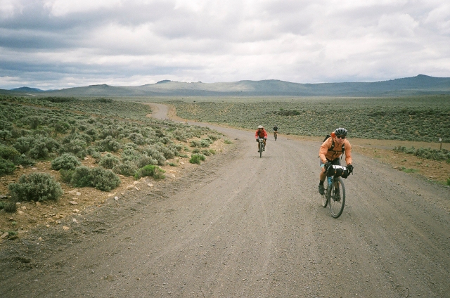
Cyclists riding an endless dirt road

I think it’s funny that we went to great lengths to ride Amtrak down with the group. We stayed at the hotel where everyone departs, but when it comes close to “Grand Depart” time, we decided to head out a half hour early to “beat the pack” and avoid traffic. We had a 7:30 pm reservation at the Cowboy Dinner Tree. Not to be missed, they say. 30 ounces of steak, they say. Someone said if you want to catch your dinner time on day one, you’d better leave early.

Cyclists riding an endless dirt road

We roll out into cattle country and promptly flat at mile 43. You just have to give into these occurrences and help out as you can. We triple-team the flat change. Someone gets out the fresh tube and pumps it. Steve checked the casing and found a crazy little razor sharp sliver of stone protruding. We remount and keep rolling through cow country.

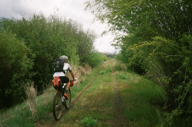
grassy trail leading upwards

How do you calculate the difference between pedaling a road bike with just two water bottles and minimal tools and a 50-pound loaded mountain bike? If math was your thing, I’m sure you could produce an equation, but I know what it feels like in my legs and in my mind.

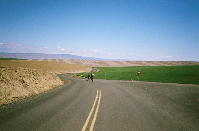
an endelss stretch of pavement

Our rollouts were pretty silent affairs. Nobody yelled “rolling out in five minutes.” You just silently stuff bags and fill bottles until it looks like everyone is ready. I like that unspoken group mind sometimes. Rolling out in the rain and chill is a bit of a somber affair that feels more like duty than a party.

Dan Sharp zips his jacket

My right knee started to hurt at this point my mind started wondering if this was a trend, or just a momentary thing. Pavement turned to dirt, which led us to miles of descending. So much descending that you have to stop and rest and keep pedaling just to stay engaged. At this point we meet up with Bear Creek and things just get greener as we approach the reservoir. One last killer climb, though before a killer descent to the reservoir.

Rest break

Prineville was a turning point in our Outback. Mileage-wise we had completed 225 miles of the 363. Having completed two days was a huge boost in confidence. At this point, it felt like our bodies were adapting to the work and rhythm of bike by day camp by night. We started to get a feel for how much food we needed to pedal all day.

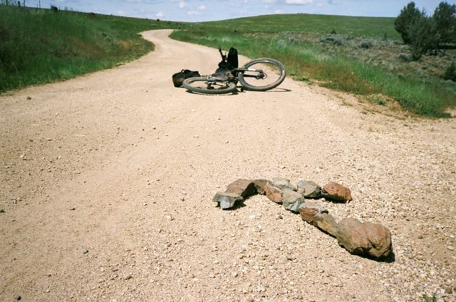
stone arrow

I just keep making little goals. Just make it to that tree. Just make it to that rise up there. At some point the pure climbing gives way to rolling terrain, so good-sized climbs alternate with healthy descents.

distant riders on a long dirt road in a forest

“Rise and shine cowboys – time to hit the road and pedal those bikes” yells a local woman cruising mainstreet at 6 am. She inspects a falling handrail on the vacant hotel and mutters something about how someone needs to get on these repairs. I think the hotel looks pretty good considering it was built in 1900. I read that the hotel shut its doors in 2009. At 7am one of the Outback riders rings the large bell next to the City Hall.

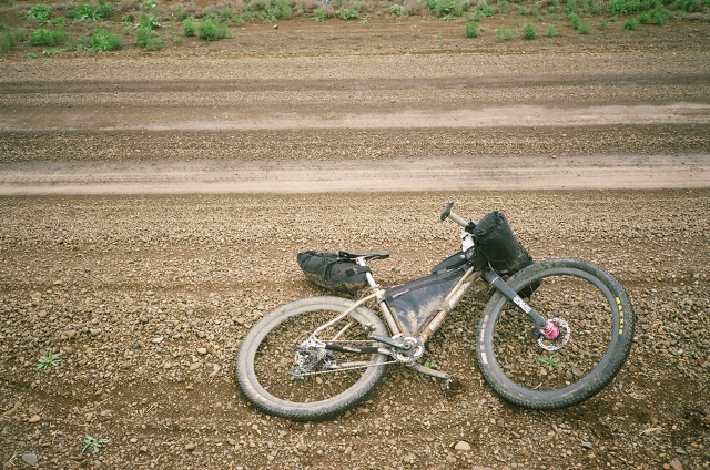
Dan's bike lying on the side of a dirt road

And that’s it. No finish line, just the Deschutes River flowing peacefully by. We jump in and it’s bracing. It feels good to be done. Cold water feels amazing and it was the first shower I had in three days…I don’t think I really doubted I could do the Outback, I just maybe thought it might be harder…and maybe it would have been with different conditions.

Daniel rides a Seven Sola 29 SL.

Find the whole story and all the photos on Daniel’s website.

On the Road – Daniel Sharp Goes Stampede Solo

One of the nice things about Daniel Sharp’s photographs and prose is that they don’t over-glorify his exploits. He acknowledges his miscalculations, his struggles and his suffering. Because that’s what adventure is, right? The intersection of suffering and fun?

This time Dan is riding solo near his Oregon home. His photos and excerpts from his trip journal below:

At some point you realize that a good weather window is a gift and that if you’re going to go, you might just have to go solo. I see the solo as a step in my progression with bikepacking. I did a couple hard solo rides in Arizona recently. One of them just about broke me, but that’s a post for the near future. Doing it solo allows you to ride your own pace, to leave when you have an opening in your schedule.

From the Velodirt site:

“The route itself is not to be taken lightly.  Expect lots of dirt and gravel with over 9,000 ft of climbing and some real rough riding in sections.  There are well spaced services, but inconsistent cell service.  As with all rides out this way, watch the weather for high winds and extreme temperatures.”

The other great thing about this route is its proximity to Portland. The start of the route is just 95 miles down 84 to the Deschutes River Recreation Area, where you can leave your car.

I love this part of the state. I think my first exposure to the area was photographing the Rapha Continental Dufur ride back in 2009. I fell in love with the undulating wheat fields and picture-perfect farms. I love how open and dry it is compared to the dense forest of the Cascades. But starting that climb up Company Hollow you’re reminded that it’s going to be a long day through some of the most beautiful and lonely roads in Oregon. The road to Dufur is not easy on a loaded mountain bike. There is about 1300 feet climbing in 40 miles. I kept imagining how much easier it would be on a road or cross bike.

That might be the best part of a solo trip. I stop when I feel like it. I don’t feel rushed when I want to take a photo. I stop and snap photos and eat some salami and cheese and I enjoy being the only person out there. OK, one farmer did just drive by in a cloud of dust, but just one. I kept feeling like WOW it’s really pretty desolate out here, but at that moment I’d come across another farm or abandoned building.

I’m glad to have a GPX track to follow here, since there are many roads that diverge and look just as well traveled. At one point I take what looks like the obvious turn only to check my Garmin and see I chose wrong. That only happens once, but I can see how you could get lost in here. For the first time on this trip I’m happy to have a mountain bike. Water runs down the trail and I’m having to chose lines or get stuck in ruts and the occasional field of rock scrabble. What a treat, though! It’s gorgeous and it really makes the route feel like an adventure. I’m happy it’s not all dirt roads. By the third stream crossing I’m in the zone. I stop several times for photos.

This is definitely an area that I’d like to come back to explore more. I’m still feeling like I need to push on a bit to Tygh Valley. I’d camp here, but I want to make a few more miles today and Donnie mentioned it could get cold in here this time of year and my sleep system is on the cold side, so I’ll push on. Just outside of the Wilderness area I stop to filter water for dinner and breakfast. At this point it’s all downhill and paved to Tygh Valley. A group of deer cross the road in front of me and bound effortlessly over barbed wire fence and into an empty field. Late afternoon light filters in through trees and I feel the euphoria of arriving in a new place under my own power. This is one of those moments where I feel golden. I know this is special. I savor it. I stop in an old pioneer cemetery and take photos.

I love arriving at my destination at this hour. The road is gorgeous and curves back around towards town. Tonight I’ll be the only camper at the Fairgrounds – only human for that matter. No one comes out to ask what the heck I’m doing, so I set up next to a picnic table and start boiling water for dinner and setting up my tent. I just pumped water and I’ll be able to charge my phone in the outlets, so I’m all set. I’m surprised how few cars drive by. I’m not wasted tired, but lack sufficient curiosity to venture into town, so I just set up camp, eat buffalo chili and look at maps. It was a good day.

The solo overnighter is a nice quick-fix outing. I’m pleased with my effort. Nothing crazy went down. I didn’t encounter another cyclist on route. I saw a few deer, some farmers in pickups, but I’m struck how easily it is to get away from the city and visit some very quiet parts of Oregon. Now that I’ve got a few rides under my belt, it feels natural to grab camping gear and food and get away for a couple days. This would be a great shakedown for Oregon Outback. In fact, the last 33 miles of the Outback are the same as the Stampede route. The Outback just climbs another 5000 feet over an additional 230 miles. The reason to do these ‘easy’ routes is that you build up your confidence and remind yourself of what works and what doesn’t.


Read the unabridged adventure and see more of Daniel’s exquisite photos while you’re at it. Daniel rides a Seven Sola 29 SL.

On the Road: Dan Sharp in Oregon

It is easy to fall into the trap of the big ride, the grand statement. Why ride if you’re not going to put up big miles? Why stop to enjoy the view, if you’re not at the Grand Canyon. But adventure is everywhere, on our daily commutes, at our local trail systems, down roads we’ve just never turned onto before. Daniel Sharp lives in Portland, Oregon, and though his ambitions took him to the Alaskan backcountry, he is also willing to engage the wild in his own backyard, as on a recent trip from the Hood River to the Dog River.

Below you’ll find some of his thoughts on the trip.

Not all adventures are created equal. I wrote my friend Andy Waterman about doing an adventure for Benedicto and he mentioned  Alastair Humphrey’s book Microadventures. I like the idea that not every adventure has to be an epic. Epics require lots of planning, free time, and money. Our Alaska trip was a huge eye opener for us in terms of thinking about exploring roads without cars and being fairly self sufficient. Trips like that open your mind to the possibilities and get you dreaming about traveling the world by bike…But there is also reality.

The cool thing about this route is that the only driving we would have to do is down 84 an hour to Hood River. The genius of bikepacking is less car time, more riding time and you really enjoy the process of getting there. Anyone that rides a road bike in Oregon has most likely ridden the fantastic Hood River-to-Mosier trail, which is the restored portion of the Historic Columbia River Highway that is closed to cars. Sunny Saturdays are busy there with weekend warriors both young and old, so we had lots of questions as we strapped bags onto our bikes in the parking lot.

Right away I was struck with the perfect temps and the quality of the fall light. The last time Tori and I had done this route it was the first week of July. This paved stretch is a great warm up for the day of dirt roads ahead – it’s a gentle climb to the tunnel and riders are treated to spectacular views of the gorge and a swift descent down to Mosier.

The route is good practice for long days of climbing. It’s primarily a dirt road route with a couple of rocky stretches…Really, for the climb a cross bike would be fine, but for the descent a suspension fork lets you bomb it properly. I guess our different bike setups prove the point that you can do this route on just about any bike. I’ve really been enjoying the ride quality of the Seven with 2.3 tires. With the proper tire pressure, I can really let it roll on the descents without too much stress. This ride affords some excellent views to the North of Mt. Adams, Mt. Rainier, and Mt. St. Helens. Looking East you get views towards Dufur. And of course as you climb South on the route Mt. Hood just gets bigger and bigger.

Knowing the route, I was confident three bottles would get me to the first water refill at Beaver Spring, which is 19.8 miles from our starting point, or 13.3 miles from Mosier. You have to hike in a bit off the route to get to a good place to filter, but if you follow the trampled grass and leaves on the East side of the road, and listen for the sound of running water it’s fairly obvious where to go. We also knew that we’d be camping by a water source, so we didn’t have to climb with all of our water for dinner and breakfast.

For me, it was great to share this route that challenged me three years ago on the hut trip and feel my familiarity improve with every successful run. I don’t have every turn memorized yet, so I still rely on the GPX track and the cues, but it gets easier every time. It was great to be able to share the ride!

We all marveled at how different the route seemed on day two. The morning light was different, the views were different and we got to descend everything we climbed yesterday. There was alot of incredulous “we climbed up that?” We stopped for every view we missed the day before. Sometimes the fun of bombing dirt roads won out and I had to just make a mental snapshot and keep on riding.