skip to content
Current Lead Times: Simple-Custom Framesets: 1 week. Full Custom Bikes: 7 weeks.

U.S. Built Custom Bicycles in Titanium and Titanium-Carbon Mix

On the Road: Zand Martin Cycling the Kazakh Steppe

It’s a long time since Zand Martin came to pick up his Expat S and laid all his Russian military maps on the floor in our showroom to show us what he had planned. Over the course of the expedition (see here, here, here, here, here and here), we saw things go awry and askew as some of those maps failed to reflect a workable reality for Zand and his expedition partner. And yet, they managed to see and document so many of Central Asia’s beautiful, seldom-seen locales, and we couldn’t have enjoyed seeing those landscapes more, one of our bikes a tool that helped bring back those views.

Our On the Road series is about showcasing what riders are doing with our bikes out in the world. Zand is a different kind of rider, a true adventurer and explorer, and we count ourselves lucky to be able to share his stories with you here.

More of Zand’s lovely photos and prose below:

The road has no outlet. There is no bridge, and no ferry. The map is wrong, again. We are crushed, again. We followed the main road towards Ust-Kamenogorsk as our map had it, along the shores of the great reservoir of Bukhatarmskoye. But twenty-five kilometers from anywhere, the road turns to dirt and a branch drops to a languid shore and a rusted, abandoned ferry dock. The family smoking cigarettes on the dock offers us candy and cabbage rolls, and confirms our suspicions, pointing north to the road. “Nyet parom, nyet most,” no ferry, no bridge between here and Ust-Kamenogorsk, Oskemen in Kazakh. They indicate a barge in the lake, the ferry coming to take them west across to a road that leads to Samara. It is 240 kilometers to our railhead by that route, and when the boat docks and disgorges a small truck and two Ladas, we reluctantly wheel our bikes on board.

We had taken a leisurely lunch, knowing we would camp the night by the reservoir and then have an easy morning into Ust. There, we would reach the railhead and the end of our human-powered journey around the Altai. We were fifty kilometers away, after thousands. Moments before we were exultant, our ending close and within the easy reach of a morning’s ride. Now, we are again cast into uncertainty and high challenge. We sullenly eat crackers on a bench by the railing. A trio of weathered Russian and Kazakh men loosen the steel cable loops on the ship-side bollards, and the Odessa slips out of the dock into the narrow reservoir.

We had spent almost two weeks in the watershed, both in China, the mountains along the Austrian Road, and down in the rolling Kazakh steppe along the rivers draining to the Irtysh. Leafy villages dotted our route through the grasslands, simple settlements following a comfortable pattern: spread a handful of shops and markets along the main road, and cluster log and concrete brick houses around it with gardens and hayricks. Every town has a mosque built since the fall of the Soviet Union, often including Timurid and Persian elements like blue tile domes and large brick arched entrances. They are village affairs, humble, and tell the story of Islamic revival in Kazakhstan, encouraged from within the country, and from without.

We relish the sparse green of the villages, and eat ice creams on rickety benches while schoolchildren ask us our name and giggle at our strange accents. In Russian-influenced and settled Kazakhstan, we added cheese and butter back into our diet, along with tomato sauce and real ice cream bars. The wind, unfortunately, continued to plague us until the asphalt ran out on the outskirts of Terekty, and that new challenge gave us a reprieve until we finished the Austrian Road and returned to sealed roads. There, we pass between the mountain walls headed west. North, Siberia begins, while south, whence we came, Central Asia stretches in desert, and glacier. The wind assaulted us, again. We moved west through verdant pasture, crawling into a forty knot headwind for the tenth day. Our first night camping beyond the Austrian Road, we hide behind poplars and wake to several inches of snow. At the latitude of Seattle and the elevation of Pittsburgh.

As we near the far shore, the captain waves us up two stories to the wheel house. The sparse bridge holds a few notebooks, a throttle marked in stenciled Cyrillic, and a great wooden ship’s wheel. He shows us the controls, and jots down distances to our next town: seventy kilometers. We dock as the sun drops, and move a few kilometers on to a rise above the lake. We set tents, boil water, and settle in to our disappointment and our well-exercised muscle of moving on, laughing, and planning. In the last light, two Kazakh horsemen wander by from work in the hills along the lake. We chat, and before leaving one dismounts and urges me into the saddle. Reminiscent of childhood pony rides, the second shepherd holds my reins and we ring camp at a trot.

Of course, there’s more worth reading and seeing on Zand’s expedition 7. Check it out.


We Couldn’t Have Said It Better – Linda Freeman

A lot of our riders end up here at one point or another, coming to see where their bike was/will be born, and recently we hosted Linda Freeman who is a fitness consultant and freelance writer from Vermont. We built her bike, an Elium SLX, with our friends at Fit Werx in Waitsfield earlier in the year. If you read Linda’s 7 or her regular feature in the Rutland Herald, Active Vermont, then you know she’s a deep thinker on fitness and cycling. We had a great visit with her, which she wrote about here.


On the Road – The Blayleys in Ireland, Part III

When the Blayleys were last on the west coast of Ireland, the touring was a bit more seat of the pants. In the intervening decades, the tourist bureaus have organized, simplified and marked a vast number of routes that make seeing the grassy green sites a much less involved job. John and Pamela met John’s brother David, an archaeologist, to take in as many of the West’s sites as possible.

Catch up on the first two parts of this series here and here.

The Dartry Mountains range across the Northwest of the country in Counties Sligo and Leitrim. A series of limestone plateaus, the Dartries include Benbulbin, which features prominently in the poetry of Yeats.

Here are Pamela and David in the shadow of Benbulbin. Yeats is actually buried nearby in the churchyard at Drumcliffe.

Just inland from Benbulbin is Glenade Lough. A legend holds that a large otter-like creature called a Dobarchú attacked and killed a local maiden here in the 17th century. Neither John nor Pamela reported any sightings.

North along the coast from Benbulbin you find Fintragh Bay, just west of Killybegs, Ireland’s biggest fishing port.

North from Killybegs in Donegal is the Glengesh Pass. Things get pretty pastoral this far up, expansive sheep-dotted moors stretching away in all directions. The Pass itself is a little-traveled road that meanders through the mountains with swooping, whorling switchbacks and some precipitous descents that make for fine riding.

From Glengesh, John and Pamela headed straight out to the Atlantic Coast to see the Slieve League Cliffs, some of the highest sea cliffs in Europe, and were rewarded with the rainbow below, one of the few upsides of Ireland’s persistent rain.

The rain-slick return from Slieve League.

To see more of the fantastic photos from their trip check out their cycling 7. For those of you in New England, we also highly recommend visiting their routes page, which collects so many great rides it’ll take you years to ride them all.

On the Road: Zand Martin Cycling the Kazakhstani Altai

Look at a map of Central Asia and find the intersection of Russia, Mongolia, China and Kazakhstan. That’s where Zand and his partner are traveling, where the dots that represent cities and towns get fewer and farther between. In this installment of Zand’s adventures Circling the Golden Mountains, they enter Kazakhstan from China.

Read about the beginning of this journey here, here, here and here. As usual, find his images and journal from the trip below:

“Can you see the bridge?” Brian shouts down to me. A moment of confusion and elation pass between us. I am on the cobble marge of the Kara Koba, washing dishes from dinner with water from the stream. It is achingly cold, running fast over a polished, rocky bed. I face upriver, and below the obscuring larch and birch, I spot a span of rusted box girder. Brian sees my face, and knows what my lightbulb expression must mean.

An hour before, we had stood at the old bridgehead and watched the track run out into space. Nearby a ford roared with the freshet, and we discussed our options for the crossing. The creeping shadow line of evening encouraged dinner, sleeping bags, and procrastination until morning. With no way across the river, we were crushed, again. Two kilometers of drifted switchbacks had filled our afternoon, depositing us on the floor of the valley wet to the waist and covered in mud. Rolling out of the snowbound forest, slush dropped from spokes and racks, and we moved into sun, leaving a postholed, pannier-plowed track behind.

Now, our deliverance appears right under our noses, and we jog up to the bridge and walk out on rough milled planks wired to ancient steel. Clear snowmelt runs below, wrapping rocks in foam and racing out of the gorge above: tomorrow’s work. The way seems clear, for this moment only, and we are giddy that another puzzle piece has reluctantly found its place.

This track, once a road, was built between 1915 – 1917 by Austro-Hungarian prisoners captured on the Eastern Front in the Great War. They toiled in these remote mountains at the edge of the Russian Empire, thousands of miles from the fighting. They cut this rough track through the mountains with shovel and pickaxe, rope and saw, bridging the Kara Koba five times in the wild gorge just upstream from us. They connected the valley of the Burkhtarma, once the northern route on the great Silk Road, with China and the basin of the Cherny (Black) Irtysh.

For their achievement, the track is still called the Austrian Road. The Czech, Slovak, Austrian, and Hungarian prisoners who labored in this remote wilderness left no trace save the occasionally level path cut into the hillside and over these successive passes and gorges. They worked and died as two empires collapsed around them: their own, and that of their captors. As the storm of revolution broke in 1917, this small work gang was surely caught in the middle. Were they repatriated by Trotsky in time? Or did they join the Czechslovak Legion in its long fight from Europe to the Pacific, and race the nascent Red Army along the Trans-Siberian Railroad in armored trains bound for Vladivostok and Allied evacuation to America? No one knows.

We left China in storm and wind, hoping our way would be smoother in Kazakhstan. Things did not start well. We were held at the border for seven hours as Chinese officers looked through the photos on our cameras and the Kazakhstan guards asked us about Jessica Alba, our homes (“Please tell us one thing your state is known for.”), and our plans for their illustrious country. All this, before they informed us our visas are fake and we cannot enter the country – Kazakhstan does not issue five-year visas to Americans. Except that they do. Once the immigration office in Astana finished its three hour lunch break, they informed our erstwhile captors that the rules had changed last year, and to let us go. One would think knowing current visa rules would be a top priority for boarder guards.

We followed the border fence north. The wind hounded us until the road turned to dirt and began to climb. The thousand-foot dunes of the Ak Kum desert (‘white sands’) reflected bright sunshine behind, and as usual the land gave no shade. We sweat, and salty Rorschach lines grew on shirt and hat as sandy gravel switchbacks turned desert to steppe, then to scrub and subalpine meadow. The air cooled as the road climbed, rising 3200′ in under ten kilometers, making it a bit steeper than the Mt. Washington Autoroad with a worse surface condition. Beyond the Mramorniy Pass, we rolled over the White Pasture of Akzhailau and ascended a second pass, Tikkabak, where conifers appeared and we caught our first glimpse of mountains wreathed in snow.

In this exertion, we worried about our border permits. We had arranged for them to be processed in February, but our contacts had failed us spectacularly and only informed us a few days before we entered the border zone that we did not actually have permission to be there. Our afternoon cycling along the actual border fence was one of worry and uncertainty, but as we climbed we committed ourselves to this route; it would add 350km to go back and around the mountains. With every checkpoint, police jeep, and document request, we escaped unstopped, still, miraculously, fixed on our goal. The rangers, soldiers, police, schoolchildren, horsemen, and shopkeepers that asked us our route all nodded, some pointing back the way we had come, saying the road disappeared if we went north long enough. Beyond the great lake of Markakol, a park ranger pulled his jeep over to tell us the Austrian Road would be impassible and we wont reach the Burkhtarma. When we insist, he smiles and wishes us good luck. We have found, so far on this trip, that everyone is nearly always wrong, and the only way to know what lies ahead is to go and have a look for yourself. If there are any grains of truth in their advice, they will reveal themselves.

A kilometer later, the next bridgehead appears, with the girders swept parallel to the far shore with planks sloughed off into the current twenty feet below. The mountainsides drop to the river in mixed meadow and taiga, and we scout the left bank, sure of our forward momentum. In two hours of heavy lifting, we portage along cliff bands and over frozen avalanche debris, walking in the river when necessary. The third bridge stands, repaired at some point with sawn telephone poles still sporting their wire hangers. On bridges four and five, the planks are gone, leaving only the bent, rusted girders, and we engineer solutions our mothers are encouraged not to ask us about. In nine hours of extreme effort, we make eight kilometers.

The track is mud, rock, and snow. It rises against mountains now considering spring in carpets of wildflowers, European globe-flowers and irises purple and yellow, ruthenica and bloudowii. Snowfields beckon above forest bands, but with such a slow day, our food won’t last and we are wary of what slow, grinding hardship will present itself on the morrow. The skis stay on the bikes, but we stop from time to time and gaze up at the ridges still holding their snow, at the Sarymsaty (‘Garlic’) Ridge, and onwards to Burkitaul and Aksubas Peaks, ‘Eagle’s Eyrie’ and ‘Head of White Water’, respectively.

The land is stunning, and utterly empty in this season. There is no one in the valley of the Kara Koba, the last mountain village of a few hundred nearly two days behind. We soak in the green, white, and blue, the moisture of a clean, alpine landscape. The steppe worked us, but here, despite the absurd physicality of the travel, we are revived. Cresting our last high point the next morning, we are confronted by the valley of the Burkhtarma. This is the Burkhatskiy Pass, and, along with the Tarbagatay Ridge, marks the vague, shifting ecological boundary between Siberia and Central Asia. To the north, we see Russia and Belukha, the great glacier-clad peak at the heart of the Altai Mountains. Three thousand feet below, the valley opens and we see the arrow-straight asphalt ribbon that will connect us again with civilization.

For even more from Zand about his adventures in the Golden Mountains, the Altai, check out his 7 from the trip.

Check out the bike Zand rode on the trip.


On the Road – The Blayleys in Ireland, Part II

It’s been a hard couple of years on the bike for Pamela Blalock. In June of 2013 she was hit head on by another cyclist coming at her on the wrong side of the road, breaking her collarbone. Then, three months later she was hit by a truck, from behind. The resulting surgery left her with fused vertebra and, ironically, a whole litany of titanium screws and supports. She broke six ribs and spent four months in a back brace. She got back on the bike last April, but has been doing physical therapy and dealing with chronic pain continuously since then.

By the time she and John got to Ireland this year she had missed a lot of saddle time. In fact, the last of their annual trips to John’s homeland, she’d spent the whole time walking mile and miles through Dublin’s rambling streets and urban parks. She had dreamed of getting back on her bike. This year, getting from Dublin to the west coast, where they’d not been in nearly twenty years, was something of a redemptive pilgrimage for her, each ride a rich reward for pain endured and time passed.

In Scotland, the lakes are lochs, the most famous of which is Loch Ness, with its deep, dark water and its monster. The Irish equivalent is a lough, and the west of the country, Galway and Connemara are marked by two massive inland lakes, Lough Corrib and Lough Mask.

This photo was taken from the road above Lough Corrib. Old stone walls cut the farm fields into grazeable portions for the local sheep.

This is the road down to Lough Mask. Rolling banks of gray clouds hint at the sudden and torrential rain that leave you feeling you earned whatever view the day afforded.

This is the grass-corrupted double track to Westport in Connemara during a brief spasm of sun. These roads all rise and fall like the country’s erratic heart beat.

Here is the dark and wet portion of the Westport loop, fluoro vests keeping the riders from disappearing into the slate gray day.

The Sheeffry Mountains (the Irish translation is “Hills of the Wraith”) in County Mayo offer cyclists miles of these rough, narrow roads. This shot, taken in Sheeffry Pass, captures the elemental nature of riding in Ireland.

the long trail

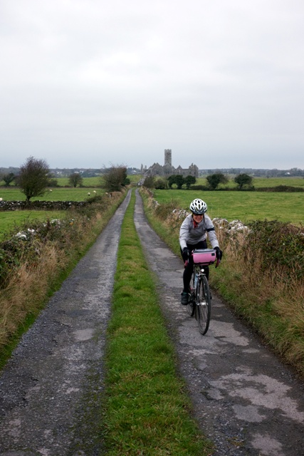
This the road from Ross Errilly Friary in County Galway, a medieval Fransiscan outpost among the oldest and best preserved such structures in Ireland.

The River Bundorragha south of Fin Lough, popular with fly-fishermen.

This is Kylemore Abbey, a 70 room castle built in the 1870s, by a wealthy London doctor. It sits in western Galway on the shore of Lough Pollacapall. It was converted to a Benedictine Monastery in the 1920s. Today the estate is surrounded by walled, Victorian gardens.

The Sky Road, west of Clifden, Connemara, Galway. On a clear(er) day, the Sky Road overlooks Clifden Bay and its offshore islands, Inishturk and Turbot.

Come back to see more from the Blayley’s Irish adventure, and their pilgrimage to the west of the country, or read more of their adventures on their own cycling 7.